Well-known natural wonders such as Flume Gorge and the Basin are spectacular destinations for a quick winter hike – however, this 1.5 mile hike up the Falling Waters Trail will bring you by three remarkable waterfalls, making it a worthy rival to the more popular water-features in Franconia Notch State Park. The hike described below will take you all the way up to Cloudland Falls, an impressive 80-foot wall of frozen water, while passing the beautiful Stairs Falls and Swiftwater Falls along the way.
Cloudland Falls Hike Info:
Stairs Falls – 0.8 mile
Swiftwater Falls – 1.0 Mile
Cloudland Falls – 1.5 Mile
Difficulty – Moderate (micro spikes, crampons or snowshoes are highly recommended – trekking poles can be helpful for the multiple water crossings)
Trail Map for Franconia Notch State Park
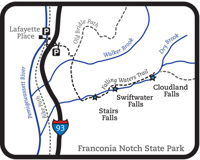
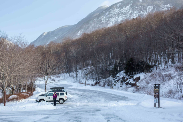
The trailhead and parking area for Falling Waters Trail and Old Bridle Path is conveniently located off of 93N about a mile and a half past the Basin exit (If traveling south bound, take the Lafayette Place exit and use the highway underpass walkway).
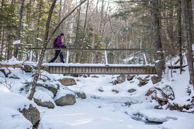
The hike up Falling Waters Trail begins on a gentle slope through mostly hard-wood forest with an abundance of beech, yellow birch and maple. After about .2 miles you’ll reach a trail junction for Old Bridle Path. Bear right here and cross the footbridge over Walker Brook.
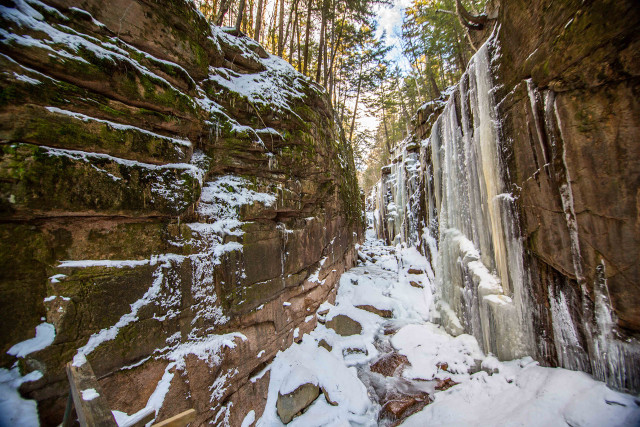
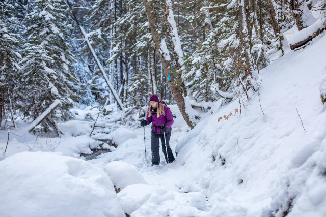
The trail continues to ascend gradually through the open hardwood forest until you reach Dry Brook. Mind your footing here as you cross the brook as there is no bridge to help you across. From here the trail veers left and climbs parallel to Dry Brook, amplifying the sound of falling water as well as providing some interesting views down into the stream. The trail also becomes steeper and more difficult from this point on and the need for micro spikes or other traction device will become more apparent.
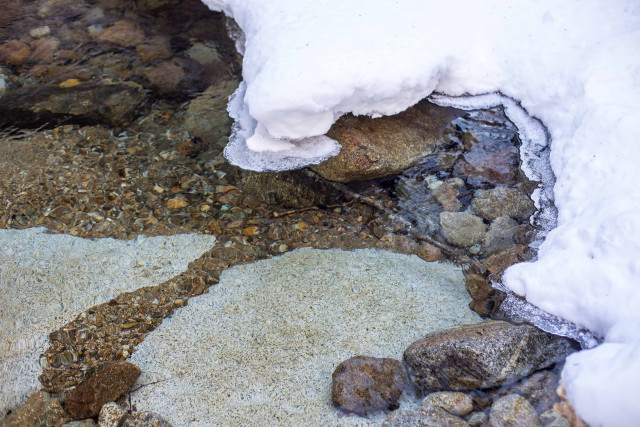
After a short distance you’ll arrive at Stairs Falls (.08 mile). Although this is the smallest of the three falls on this trip, it may be the most beautiful. On the day we went there was still open water running over the ‘stairs’ providing an interesting composition for photographers who enjoy capturing long exposure of running water with a steady tripod.
There are plenty of good spots to pull off the trail and admire the falls here and it’s fairly easy to climb down into the bed of Dry Brook for a closer look.
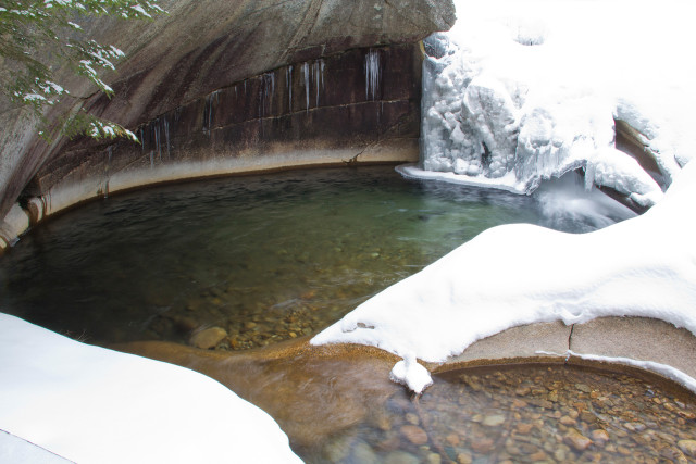
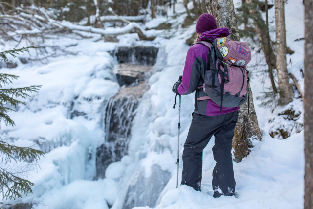
As you continue your climb alongside the brook the sounds of rushing water build excitement as you approach the larger falls. It won’t take long to reach Swiftwater Falls, and here again you’ll need to cross the water with some careful rock-hopping. While these falls are not overly impressive in winter, the clear, deep pool at the base of the falls is remarkable and draws you in to contemplate the calming power of such babbling brooks.
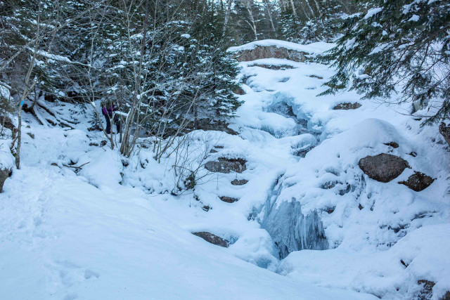
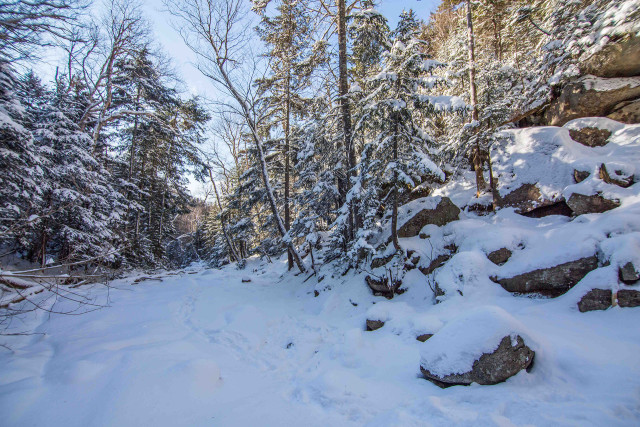
From here the trail climbs steeply up the left side of the falls leading to a few more challenging sections of this hike. In-between Swiftwater and Cloudland there will be some boulders to scramble and parts of the trail traverse the sheer slope of Dry Brook Ravine with a sharp drop down to the brook below. Now surrounded by dense evergreens, this is also one of the most beautiful parts of the hike and provides some beautiful views up and down the ravine.
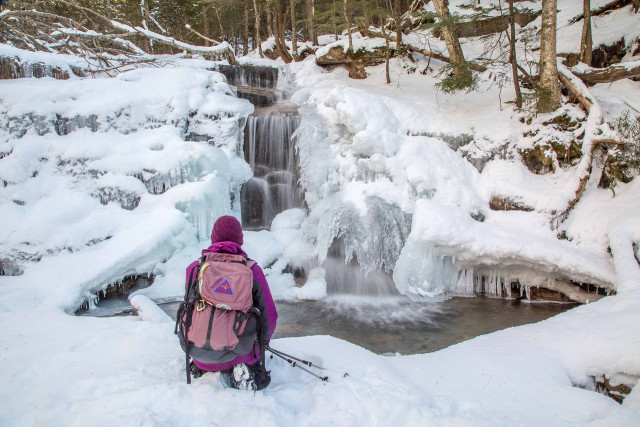
Just before you get to Cloudland Falls the trail drops back down to the bottom of the ravine and closely follows the brook. As you approach the Cloudland you’ll be able to climb down to the stream bed and make your way right up the foot of the falls. When we went in mid-January, Cloudland Falls had already been transformed into an enormous cascade of thick, bluish ice. In a few spots you could see still water gushing behind the icy curtains.
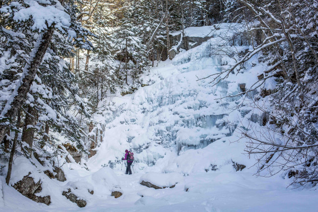
The bottom of the falls is a logical place to break and take it in. However, the views from the top of the falls are spectacular and if you can manage the additional climb it’s well-worth the effort. The trail continues up the left side of the falls and it’s worth noting that this section is very steep and rocky/icy and may not be suitable for less experienced hikers. Even with micro spikes or crampons you’ll want to be cautious and take your time climbing up (and down).
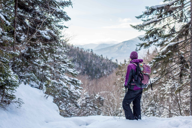
When you reach the top of Cloudland Falls you can walk across the flat ledge to the lip of the falls. From this vantage point there are excellent views across Franconia Notch to Kinsman Ridge and Mount Moosilauke further in the West.
Hope you get to enjoy this hike in winter! Another nice thing about this hike is that it’s only a half day trip and when you get back down there may still be time to stop by those other Natural Wonders of Franconia Notch State Park before heading home: Flume Gorge or the Basin!